🌿 Auto Detection of the French Hedgerow Networks
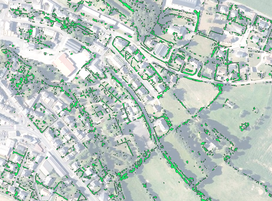
The TopoExport team is excited to announce the completion of our new automatic hedgerow detection algorithm.
This feature marks a major step forward in the mapping and analysis of rural vegetation structures across France.
Why Map Hedgerows?
Hedgerows play a crucial role in environmental balance and landscape identity. They act as:
- 🐸 Biodiversity reservoirs and ecological corridors
- 🌾 Natural barriers against wind and soil erosion
- 💧 Regulators of local hydrology
- 🌍 Carbon sinks and strong indicators of rural landscape structure
What’s the Difference between Hedge or Bocage?
- A hedge is a linear vegetation feature composed of shrubs, bushes and/or trees.
- Bocage refers to the broader, structured network of hedgerows across a territory creating a connected vegetation mesh that shapes agricultural plots, borders roads and rivers and defines rural landscapes.
Our Approach
The hedgerows we detect are modelled as surface polygons, representing the ground projection of tree and shrub canopies. This method enables detailed visualization of:
- 🌿 Vegetation continuity and interruptions
- 🌳 Differences between shrubby hedges and tree-lined hedges
- 🌲 Isolated groves
- 🕸️ vegetation networks
Our goal is to provide a complementary dataset to BD Haie V2 (March 2024), which is primarily derived from aerial imagery. By working directly from IGN’s HD LiDAR, we offer a sharper, canopy based representation of the French bocage.
What Can This Geodata Be Used For?
- 📈 Quantifying hedgerow density per km²
- 📏 Measuring hedge length, width and structural thickness
- 🧠 Integrating hedgerow data into ecological, hydrological or climate models
TopoExport Services
If you are a design office, landscape architect, environmental consultant or municipality looking to identify hedgerows, assess vegetation structure or analyze rural landscape dynamics. The TopoExport Teams can assist you. We offer custom LiDAR based studies, delivering precise hedgerow detection, canopy surface mapping and detailed ecological metrics on your specific area of interest.
Sources
This project was made possible thanks to IGN (Institut national de l'information géographique et forestière) and its LiDAR HD program.