🫧 On-Demand Digital Twins Powered by HD LiDAR
At TopoExport, we are moving closer to a key milestone: the automatic generation of high-fidelity digital twins on demand, directly from HD LiDAR data.
Digital twins are no longer a futuristic concept reserved for large infrastructure projects. Architects, urban planners and landscape designers increasingly expect accurate, contextual 3D site models that reflect the real world. The challenge is not the lack of data. It is turning complex geospatial datasets into usable production-ready models.
This is precisely the gap we are working to close.
Our Objective: High-Fidelity Vegetation and Buildings
Over the coming weeks, TopoExport will introduce vegetation and built environment datasets reaching a very high level of realism for French territories, with broader coverage to follow.
Our work is based on GIS synthesis of multiple layers derived from IGN HD LiDAR, carefully processed and recombined to produce coherent, structured 3D models. Rather than exposing raw point clouds or highly technical formats, we focus on delivering actionable geometry that fits directly into design and BIM workflows.
Individual Trees, Reconstructed Automatically in 3D
One of the most demanding aspects of digital twin generation is vegetation modeling. Trees are complex, highly variable objects and generic placeholders are rarely sufficient for serious analysis or design.
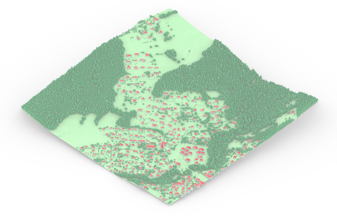
Using HD LiDAR point clouds, we are now able to automatically reconstruct individual trees in 3D, each one modeled as a unique object. Every tree is parameterized, allowing adaptation to different levels of detail and use cases:
- Canopy height ;
- Canopy diameter ;
- Trunk width ;
- Adjustable point density and mesh complexity.
This approach enables anything from lightweight contextual models to highly detailed representations suitable for visibility studies, landscape design or environmental analysis.
LoD2 Buildings from LiDAR and Footprints
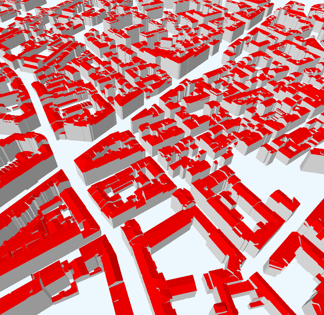
Buildings are another cornerstone of reliable site context. By combining 2D building footprints with HD LiDAR data, we automatically generate LoD2 buildings with roof modeling.
Thanks to semantic attributes, we clearly distinguish between:
- Wall geometry ;
- Roof geometry ;
A wide range of roof typologies is supported, including mono-pitch, gabled, hipped, half-hipped, mansard, pyramidal, shed roofs, asymmetric forms and more. The result is a structured, BIM-ready model that reflects real architectural diversity rather than simplified extrusions.
HD Terrain: A Better Foundation for Analysis
Terrain is often underestimated, yet it underpins almost every spatial analysis. Leveraging HD LiDAR significantly improves the quality of Digital Terrain Models (DTM) and unlocks more reliable downstream uses:
- Finer surface modeling ;
- More accurate runoff and hydrological analysis ;
- Greater reliability compared to traditional raster-based DTMs.
Instead of working around the limitations of coarse terrain data, designers can start from a surface that closely matches real topography.
From Raw Data to Usable Models
As with most geodata challenges, the core issue is not data availability. it is accessibility. HD LiDAR datasets are powerful but complex, typically stored in formats and structures designed for specialists.
TopoExport’s role is to transform this complexity into simplicity:
- Clean, structured GIS syntheses ;
- Ready-to-use 2D and 3D outputs ;
- Formats adapted to design BIM and visualization tools.
DXF, IFC, OBJ, STL and more are already available today.
What This Means for Professionals
If you need:
- Contextual site models ;
- Urban-scale 3D environments ;
- Automated production of accurate 3D data from LiDAR.
We can support this type of production, both today and increasingly through automated workflows.
All our LiDAR-based work will soon be available directly on the TopoExport platform and by using the API extending the same on-demand logic to high-fidelity digital twins.